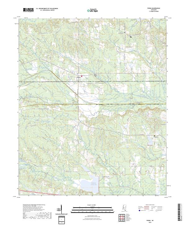
2024 Map of Pheba
USGS Topo · Published 2024About this map
Pheba serves as the central hub of this Mississippi landscape, where the northern reaches of the Black Prairie meet the headwaters of several critical drainages. The area is defined by a dense network of watercourses, including the westward-flowing Biba Wila Creek and the meandering Sun Creek, which traverse the boundary between Clay and Oktibbeha Counties. This territory reveals a long history of rural settlement, evidenced by the scattered locations of Methodist Cem and Mount Zion Cem in the north, and Pearsons Chapel Cem to the southeast. To the south, the Oktibbeha County Lake provides a significant water feature amidst the timbered tracts and agricultural fields. The transport network is comprised of numerous family-named roads like Polly Bell Rd and Hugh Mosely Rd, reflecting the generational footprint of local landowners on the land.
Find a feature on this map
59 named features on this map. Tap any name to fly to it.
Don’t see what you’re looking for? This feature index may not catch every label — zoom into the map to look around manually.
Map Details
Editions of this 2024 Pheba Map
This is the sole edition of this map. No revisions or reprints were ever made.
Other maps of this area

1953 · West Point
USGS Topo · 1:250,000

1958 · West Point
USGS Topo · 1:250,000

1959 · Pheba
USGS Topo · 1:62,500

1963 · West Point
USGS Topo · 1:250,000

1965 · Starkville
USGS Topo · 1:24,000

1965 · Longview
USGS Topo · 1:24,000

1972 · Maben
USGS Topo · 1:24,000

1972 · Mantee
USGS Topo · 1:24,000

1972 · Double Springs
USGS Topo · 1:24,000

1982 · West Point
USGS Topo · 1:100,000