
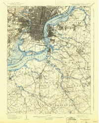
1943 Map of Philadelphia
USGS Topo · Published 1943About this map
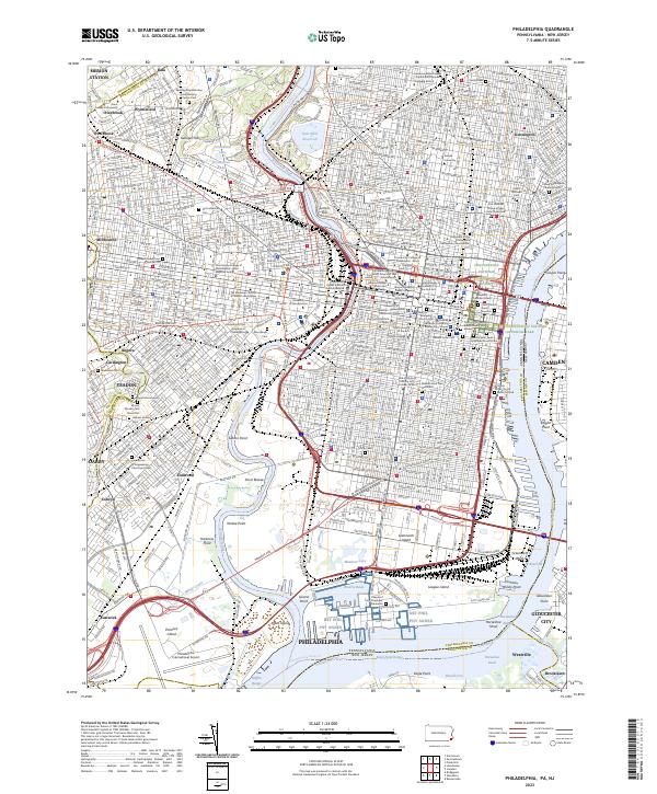
The Delaware River and Schuylkill River define the industrial and maritime character of this region during the early 1940s. Centered on the dense urban grids of Philadelphia and Camden, the map illustrates a landscape heavily influenced by defense and transportation infrastructure. Significant military installations like the U. S. Navy Yard at League I and the riverfront Fort Mifflin stand as prominent landmarks.
Find a feature on this map
120 named features on this map. Tap any name to fly to it.
Don’t see what you’re looking for? This feature index may not catch every label — zoom into the map to look around manually.
Map Details
Editions of this 1943 Philadelphia Map
This is the sole edition of this map. No revisions or reprints were ever made.
Historical Maps of Fairview Through Time
10 maps found

1891 Philadelphia
Philadelphia County, PA

1894 Philadelphia
Philadelphia County, PA

1896 Philadelphia
Philadelphia County, PA
1898 Philadelphia
Philadelphia County, PA

1920 Philadelphia
Philadelphia County, PA
1943 Philadelphia
Philadelphia County, PA
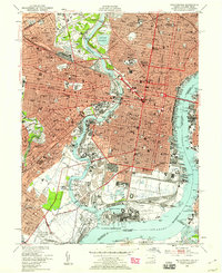
1949 Philadelphia
Philadelphia County, PA
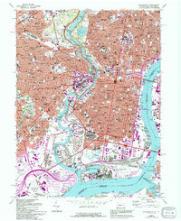
1967 Philadelphia
Philadelphia County, PA
1995 Philadelphia
Philadelphia County, PA
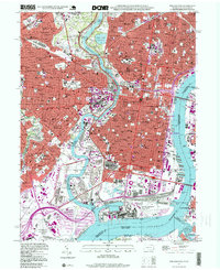
2023 Philadelphia
Philadelphia County, PA