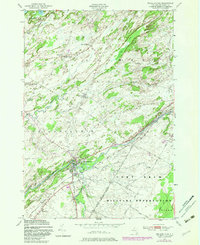
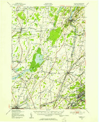
1949 Map of Philadelphia
USGS Topo · Published 1983About this map
Philadelphia serves as the primary hub of this Jefferson County landscape, situated at the confluence of the Indian River and Otter Creek. The 1949 survey, with photorevisions through the early 1980s, reveals a rural economy organized around numerous crossroads settlements such as Bentleys Corners, Bishops Corners, and Halls Corners. A significant portion of the southeastern quadrant is occupied by the Fort Drum Military Reservation, showing the interaction between the local community and the federal installation.
Find a feature on this map
28 named features on this map. Tap any name to fly to it.
Don’t see what you’re looking for? This feature index may not catch every label — zoom into the map to look around manually.
Map Details
Editions of this 1949 Philadelphia Map
Other maps of this area

1903 · Alexandria Bay
USGS Topo · 1:62,500

1903 · Theresa
USGS Topo · 1:62,500

1911 · Antwerp
USGS Topo · 1:62,500

1912 · Hammond
USGS Topo · 1:62,500

1943 · Redwood
USGS Topo · 1:31,680

1944 · Hammond
USGS Topo · 1:62,500

1948 · Theresa
USGS Topo · 1:24,000
1948 · Black River
USGS Topo · 1:24,000
1948 · Theresa
USGS Topo · 1:62,500

1948 · Alexandria Bay
USGS Topo · 1:62,500