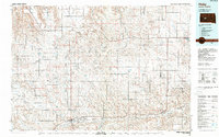
1984 Map of Philip
USGS Topo · Published 1989About this map
Philip serves as the central hub for this expansive section of Haakon County, situated where the Chicago and North Western rail line parallels the winding course of the Bad River. The landscape is defined by its drainage systems, with the North Fork Bad River and South Fork Bad River converging to form the primary waterway. High points like Grindstone Butte provide vertical relief against the broad plateaus of Kunkle Flat and Hudson Flat.
Find a feature on this map
55 named features on this map. Tap any name to fly to it.
Don’t see what you’re looking for? This feature index may not catch every label — zoom into the map to look around manually.
Map Details
Editions of this 1984 Philip Map
This is the sole edition of this map. No revisions or reprints were ever made.
Other maps of this area

1951 · Capa
USGS Topo · 1:24,000

1951 · Capa NW
USGS Topo · 1:24,000

1953 · Belvidere NE
USGS Topo · 1:24,000

1953 · Philip Junction
USGS Topo · 1:24,000

1953 · Philip
USGS Topo · 1:24,000

1953 · Philip SE
USGS Topo · 1:24,000

1953 · Rapid City
USGS Topo · 1:250,000

1954 · Belvidere NW
USGS Topo · 1:24,000

1954 · Kadoka NE
USGS Topo · 1:24,000

1954 · Powell
USGS Topo · 1:24,000