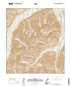
2017 Map of Philip Smith Mountains A-5 NE
USGS Topo · Published 2017About this map
Atigun Pass and the high peaks of the Brooks Range dominate this modern survey of the North Slope. The landscape is defined by the vital transportation corridor carved through the mountains, where the Dalton Highway and the Alaska Pipeline run parallel to the Atigun River. This represents a critical point in Arctic infrastructure, showing the engineering required to traverse the continental divide at one of Alaska's most significant mountain passes. To the west of the river valley, James Dalton Mtn rises as a prominent landmark, overlooking the complex series of glacial valleys and drainage systems that characterize the region. The map provides precise detail on the elevation changes and hydrology around the headwaters of the river, documenting the intersection of industry and extreme terrain in the early 21st century.
Find a feature on this map
9 named features on this map. Tap any name to fly to it.
Don’t see what you’re looking for? This feature index may not catch every label — zoom into the map to look around manually.
Map Details
Editions of this 2017 Philip Smith Mountains A-5 NE Map
This is the sole edition of this map. No revisions or reprints were ever made.
Other maps of this area

1951 · Brooks
USGS Topo · 1:250,000

1956 · Philip Smith Mountains
USGS Topo · 1:250,000

1964 · Philip Smith Mountains
USGS Topo · 1:250,000
1971 · Philip Smith Mountains A-5
USGS Topo · 1:63,360
1971 · Philip Smith Mountains A-4
USGS Topo · 1:63,360
1971 · Philip Smith Mountains B-5
USGS Topo · 1:63,360
1971 · Philip Smith Mountains B-4
USGS Topo · 1:63,360
2017 · Philip Smith Mountains B-5 SW
USGS Topo · 1:25,000
2017 · Philip Smith Mountains A-5 NW
USGS Topo · 1:25,000
2017 · Philip Smith Mountains A-4 SW
USGS Topo · 1:25,000