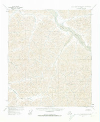
1971 Map of Philip Smith Mountains D-1
USGS Topo · Published 1974About this map
The Ivishak River winds through the high-elevation terrain of the North Slope in this early 1970s survey. As an unsurveyed region at the time, the landscape is defined by its dramatic drainage networks rather than human infrastructure. The Saviukviayak River cuts across the southwestern reaches, fed by unnamed tributaries that drain the complex ridgelines. To the west, Flood Creek flows through a series of steep valleys, illustrating the hydrological patterns of the Brooks Range foothills. Based on 1970 aerial photography, the map reflects a wilderness state before significant modern changes, recorded under the jurisdiction of the Bureau of Land Management. The lack of roads or established trails on this sheet emphasizes the remoteness of the territory during this era of Alaskan geographical study.
Find a feature on this map
3 named features on this map. Tap any name to fly to it.
Don’t see what you’re looking for? This feature index may not catch every label — zoom into the map to look around manually.
Map Details
Editions of this 1971 Philip Smith Mountains D-1 Map
This is the sole edition of this map. No revisions or reprints were ever made.
Other maps of this area

1951 · Sagavanirktok D-5
USGS Topo · 1:250,000

1951 · Brooks
USGS Topo · 1:250,000

1951 · Arctic
USGS Topo · 1:250,000

1951 · Mt. Michelson
USGS Topo · 1:250,000

1956 · Arctic
USGS Topo · 1:250,000

1956 · Mt. Michelson
USGS Topo · 1:250,000

1956 · Philip Smith Mountains
USGS Topo · 1:250,000

1956 · Sagavanirktok
USGS Topo · 1:250,000

1958 · Sagavanirktok
USGS Topo · 1:250,000

1964 · Philip Smith Mountains
USGS Topo · 1:250,000