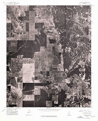
1974 Map of Philipp SE
USGS Topo · Published 1975About this map
Cascilla anchors the eastern edge of this 1974 orthophotograph, a map where the geometry of Tallahatchie County agriculture meets the wooded, irregular terrain of the bluff hills. The image reveals a stark transition from the highly structured, rectangular field patterns of the flatland bottomlands to the intricate, branching drainage patterns and dense forest cover to the east. Unlike traditional topographic maps, this aerial perspective provides a literal view of the landscape as it appeared in the mid-1970s, capturing the specific density of timber and the exact footprint of farmsteads and rural clearings. Researchers can discern the relationship between the upland woods and the cleared plains, where winding creek beds still dictate field boundaries despite the overarching grid of section lines.
Find a feature on this map
1 named feature on this map. Tap any name to fly to it.
Don’t see what you’re looking for? This feature index may not catch every label — zoom into the map to look around manually.
Map Details
Editions of this 1974 Philipp SE Map
This is the sole edition of this map. No revisions or reprints were ever made.
Other maps of this area

1932 · Philipp
USGS Topo · 1:48,000

1935 · Philipp
USGS Topo · 1:62,500

1936 · Greenwood
USGS Topo · 1:62,500

1939 · Philipp
USGS Topo · 1:62,500

1940 · Greenwood
USGS Topo · 1:62,500

1953 · Greenwood
USGS Topo · 1:250,000

1953 · West Point
USGS Topo · 1:250,000

1954 · Grenada
USGS Topo · 1:62,500

1954 · McCarley
USGS Topo · 1:62,500

1956 · Greenwood
USGS Topo · 1:250,000