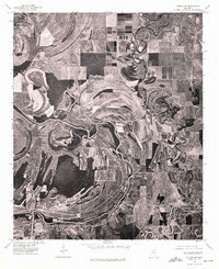
1974 Map of Philipp SW
USGS Topo · Published 1975About this map
Tallahatchie River meanders across this Mississippi Delta landscape, defining the character of the terrain through its complex system of oxbows and abandoned river channels. This 1974 orthophotoquad provides a clear view of the alluvial floodplain and the intensive agricultural patterns that have reshaped the land around the settlement of Philipp. The imagery reveals how the ancient movements of the river created fertile ridges and swales, which are vividly traced by the field lines and remaining wooded brakes. For those studying the environmental history of Tallahatchie County, the map offers a precise visual record of land use and drainage just before the mid-1970s, showing the intersection of natural river morphology and human cultivation.
Find a feature on this map
2 named features on this map. Tap any name to fly to it.
Don’t see what you’re looking for? This feature index may not catch every label — zoom into the map to look around manually.
Map Details
Editions of this 1974 Philipp SW Map
This is the sole edition of this map. No revisions or reprints were ever made.
Other maps of this area

1931 · Schlater
USGS Topo · 1:48,000

1931 · Sumner
USGS Topo · 1:48,000

1932 · Philipp
USGS Topo · 1:48,000

1934 · Schlater
USGS Topo · 1:62,500

1935 · Sumner
USGS Topo · 1:62,500

1935 · Philipp
USGS Topo · 1:62,500

1936 · Greenwood
USGS Topo · 1:62,500

1939 · Schlater
USGS Topo · 1:62,500

1939 · Sumner
USGS Topo · 1:62,500

1939 · Philipp
USGS Topo · 1:62,500