
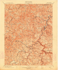
1904 Map of Philippi
USGS Topo · Published 1904About this map
Philippi serves as the focal point of this 1902 survey, situated along the winding Tygart Valley River where the Grafton and Belington railroad line tracks the water’s edge. The industrial and transit landscape of North Central West Virginia is evident in the rail spurs reaching toward Berryburg and the presence of the Baltimore and Ohio line. Beyond the river valley, the terrain is densely marked by coal-era settlements and rural post offices like Burnersville Volga P.O. and Century. Detailed watercourses like Simpson Creek and Peeltree Creek carve through the landscape, defining the boundaries of districts such as Elk and Pleasant. Significant local landmarks, including Peter's Mill and the Buckhannon Bridge, provide a clear view of the infrastructure supporting these small communities at the start of the twentieth century.
Find a feature on this map
82 named features on this map. Tap any name to fly to it.
Don’t see what you’re looking for? This feature index may not catch every label — zoom into the map to look around manually.
Map Details
Editions of this 1904 Philippi Map
2 editions found
Other maps of this area

1886 · St. George
USGS Topo · 1:125,000

1889 · Beverly
USGS Topo · 1:125,000

1891 · St. George
USGS Topo · 1:125,000

1892 · Beverly
USGS Topo · 1:125,000

1893 · Buckhannon
USGS Topo · 1:125,000

1896 · Buckhannon
USGS Topo · 1:125,000

1897 · Buckhannon
USGS Topo · 1:125,000

1902 · Clarksburg
USGS Topo · 1:62,500

1902 · Fairmont
USGS Topo · 1:62,500

1904 · Weston
USGS Topo · 1:62,500