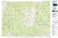
1993 Map of Philipsburg
USGS Topo · Published 1994About this map
Philipsburg sits at the heart of a region defined by high-altitude mining and timber heritage in the Sapphire Mountains and John Long Mountains. This early 1990s survey illustrates a landscape managed largely by the Deerlodge National Forest and Lolo National Forest, where historical mineral extraction is evidenced by sites like the Black Pine Mine and Silver King Mine. The central valley created by Flint Creek connects the main settlement at Philipsburg to smaller localities such as Maxville and Princeton to the north.
Find a feature on this map
36 named features on this map. Tap any name to fly to it.
Don’t see what you’re looking for? This feature index may not catch every label — zoom into the map to look around manually.
Map Details
Editions of this 1993 Philipsburg Map
This is the sole edition of this map. No revisions or reprints were ever made.
Other maps of this area

1889 · Helena
USGS Topo · 1:250,000

1893 · Helena
USGS Topo · 1:250,000

1893 · Dillon
USGS Topo · 1:250,000

1899 · Helena
USGS Topo · 1:250,000

1901 · Hamilton
USGS Topo · 1:125,000

1903 · Bonner
USGS Topo · 1:125,000

1903 · Helena
USGS Topo · 1:250,000

1908 · Philipsburg
USGS Topo · 1:125,000

1909 · Sapphire
USGS Topo · 1:125,000

1912 · Missoula
USGS Topo · 1:125,000