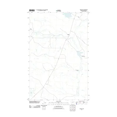
2011 Map of Phillips
USGS Topo · Published 2011About this map
Phillips serves as a central point in this northern Montana landscape, where the management of water resources dictates the layout of the land. The area is defined by its drainages and infrastructure, notably Big Warm Creek and Little Warm Creek, which feed into various man-made and natural catchments. Modern ranching and conservation efforts are evident in the presence of the KRM Ranch and the specialized engineering at Little Warm Spring Creek Dam and Ester Lake Dam.
Find a feature on this map
11 named features on this map. Tap any name to fly to it.
Don’t see what you’re looking for? This feature index may not catch every label — zoom into the map to look around manually.
Map Details
Editions of this 2011 Phillips Map
This is the sole edition of this map. No revisions or reprints were ever made.
Other maps of this area

1953 · Havre
USGS Topo · 1:250,000

1954 · Lewistown
USGS Topo · 1:250,000

1957 · Havre
USGS Topo · 1:250,000

1958 · Havre
USGS Topo · 1:250,000

1959 · Lewistown
USGS Topo · 1:250,000

1965 · West Alkali Reservoir
USGS Topo · 1:24,000

1965 · Veseth Reservoir
USGS Topo · 1:24,000

1965 · Phillips
USGS Topo · 1:24,000
1965 · Holzhey Reservoir
USGS Topo · 1:24,000
1965 · Seymour Reservoir
USGS Topo · 1:24,000