
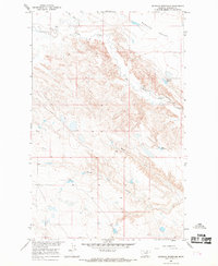
1965 Map of West Alkali Reservoir
USGS Topo · Published 1969About this map
Water management in the arid landscape of Phillips County dominates this 1965 survey, which was conducted as part of the Department of the Interior program for the development of the Missouri River Basin. The terrain is defined by an intricate network of drainage channels, notably Black Coulee and its North and South Forks in the north, and West Alkali Creek which feeds into the West Alkali Reservoir. The map documents several man-made water features essential for regional livestock and agriculture, such as Williams Coulee Reservoir, Reservoir No 161, and the aptly named Partnership Reservoir. Topographic details include several Gravel Pits and the spillway elevations for the various dams. The landscape transitions into the Rudolph area in the south, where Rudolph Coulee and Fourmile Creek flow toward Wild Horse Creek, illustrating the complex watershed system of the Montana plains during the mid-twentieth century.
Find a feature on this map
23 named features on this map. Tap any name to fly to it.
Don’t see what you’re looking for? This feature index may not catch every label — zoom into the map to look around manually.
Map Details
Editions of this 1965 West Alkali Reservoir Map
This is the sole edition of this map. No revisions or reprints were ever made.
Other maps of this area

1953 · Havre
USGS Topo · 1:250,000

1954 · Glasgow
USGS Topo · 1:250,000

1957 · Glasgow
USGS Topo · 1:250,000

1957 · Havre
USGS Topo · 1:250,000

1958 · Glasgow
USGS Topo · 1:250,000

1958 · Havre
USGS Topo · 1:250,000

1964 · Cow Creek
USGS Topo · 1:24,000

1965 · Wagner
USGS Topo · 1:24,000

1965 · Phillips
USGS Topo · 1:24,000
1965 · Seymour Reservoir
USGS Topo · 1:24,000