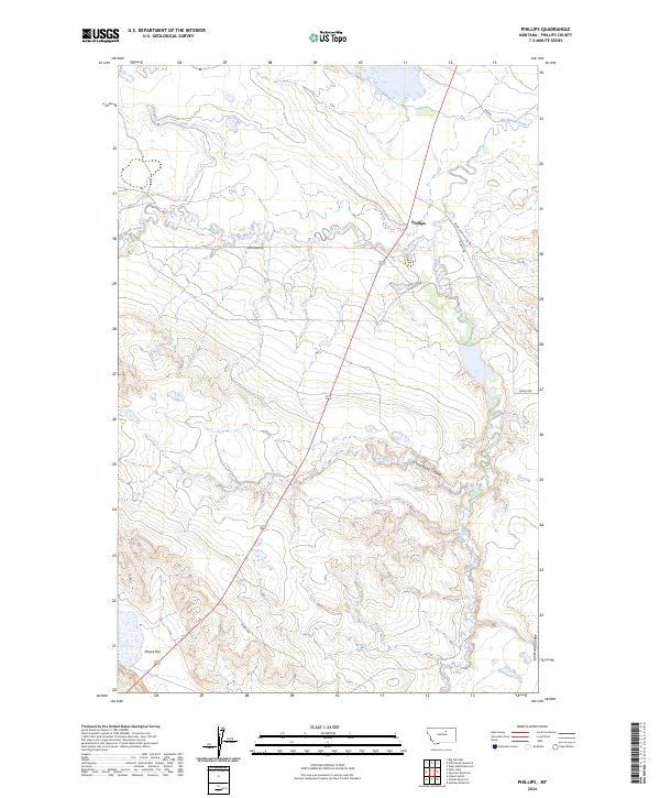
2024 Map of Phillips
USGS Topo · Published 2024About this map
Phillips marks a central point of activity in this northern Montana landscape, where the drainage of Big Warm Creek and Little Warm Creek defines the local topography. The map reveals a network of rural access roads like Hog Farm Rd and Veseth Rd, tracing the boundaries between established townships such as t27n r27e and t27n r28e. The terrain is characterized by its distinct coulees and flats, providing a clear view of the geographic transitions in Phillips County.
Find a feature on this map
16 named features on this map. Tap any name to fly to it.
Don’t see what you’re looking for? This feature index may not catch every label — zoom into the map to look around manually.
Map Details
Editions of this 2024 Phillips Map
This is the sole edition of this map. No revisions or reprints were ever made.
Other maps of this area

1953 · Havre
USGS Topo · 1:250,000

1954 · Lewistown
USGS Topo · 1:250,000

1957 · Havre
USGS Topo · 1:250,000

1958 · Havre
USGS Topo · 1:250,000

1959 · Lewistown
USGS Topo · 1:250,000

1965 · West Alkali Reservoir
USGS Topo · 1:24,000

1965 · Veseth Reservoir
USGS Topo · 1:24,000

1965 · Phillips
USGS Topo · 1:24,000
1965 · Holzhey Reservoir
USGS Topo · 1:24,000
1965 · Seymour Reservoir
USGS Topo · 1:24,000