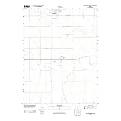
2009 Map of Phillipsburg South
USGS Topo · Published 2009About this map
Phillipsburg sits at the northern edge of this Kansas landscape, where the town's grid meets the agricultural reaches of Phillips County. The Phillipsburg Municipal Airport and Fairview Cemetery mark the transition from the settlement into a countryside defined by deep drainage patterns. Further south, the town of Glade serves as a local crossroads above the North Fork Solomon River, which meanders through the lower portion of the map.
Find a feature on this map
27 named features on this map. Tap any name to fly to it.
Don’t see what you’re looking for? This feature index may not catch every label — zoom into the map to look around manually.
Map Details
Editions of this 2009 Phillipsburg South Map
This is the sole edition of this map. No revisions or reprints were ever made.
Other maps of this area

1893 · Phillipsburg
USGS Topo · 1:125,000

1955 · Beloit
USGS Topo · 1:250,000

1959 · Beloit
USGS Topo · 1:250,000

1961 · Kirwin SW
USGS Topo · 1:24,000

1972 · Speed
USGS Topo · 1:24,000

1972 · Glade SW
USGS Topo · 1:24,000

1972 · Kirwin Reservoir
USGS Topo · 1:24,000

1972 · Phillipsburg South
USGS Topo · 1:24,000
1972 · Glade SE
USGS Topo · 1:24,000
1973 · Gretna
USGS Topo · 1:24,000