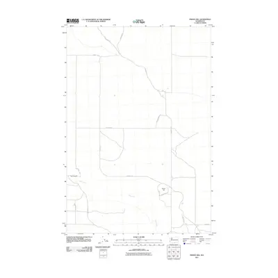
2011 Map of Phinny Hill
USGS Topo · Published 2011About this map
Phinny Hill rises above the Klickitat County landscape, defining a region where dry-land canyons and drainage systems dictate the layout of rural transit. In this early twenty-first-century survey, the winding course of Alder Creek flows through the southern terrain, carved by the deep incision of Tule Canyon. The map reveals a highly structured grid of farm and ranch access roads that reflect the agricultural heritage of the area, connecting remote homesteads via routes such as Petersen Ranch Rd and Sand Ridge Rd. The distribution of these roads, including named corridors like Alderdale Rd and Dead Canyon Rd, indicates a sparsely populated but active ranching economy. This topographic record serves as a primary source for understanding land ownership patterns and natural drainage in the eastern Washington uplands.
Find a feature on this map
18 named features on this map. Tap any name to fly to it.
Don’t see what you’re looking for? This feature index may not catch every label — zoom into the map to look around manually.
Map Details
Editions of this 2011 Phinny Hill Map
This is the sole edition of this map. No revisions or reprints were ever made.
Other maps of this area

1906 · Blalock Island
USGS Topo · 1:125,000

1908 · Blalock Island
USGS Topo · 1:125,000

1910 · Zillah
USGS Topo · 1:125,000

1915 · Prosser
USGS Topo · 1:125,000

1916 · Arlington
USGS Topo · 1:125,000

1917 · Prosser
USGS Topo · 1:125,000

1950 · Yakima
USGS Topo · 1:250,000

1953 · Pendleton
USGS Topo · 1:250,000

1953 · Walla Walla
USGS Topo · 1:250,000

1953 · The Dalles
USGS Topo · 1:250,000