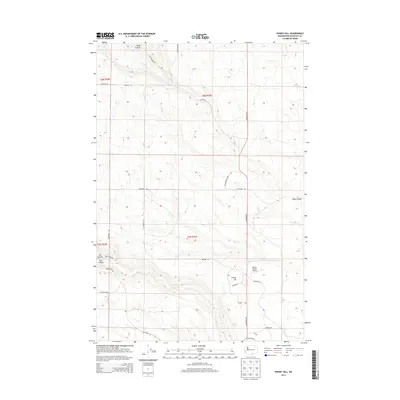
2013 Map of Phinny Hill
USGS Topo · Published 2013About this map
Phinny Hill rises as a prominent landmark in this section of Klickitat County, overlooking a landscape defined by deep drainages and rural agriculture. The terrain is deeply incised by the seasonal paths of Dead Canyon to the north and Tule Canyon to the west, while Alder Cr winds through the southern reaches. This modern survey illustrates the expansive ranching and agricultural operations typical of the Columbia Plateau, highlighted by the private Mercer Ranch Airport and a network of named tracks such as Old Ranch Rd and Petersen Ranch Rd. The layout of the roads, including Alderdale Rd and Warner Rd, follows the section lines of the Public Land Survey System, reflecting the organized, large-scale land management of the early 21st century. Dead Canyon appears again in the southeast, showing the persistent geographic influence of these basalt-carved coulees on local travel and boundaries.
Find a feature on this map
27 named features on this map. Tap any name to fly to it.
Don’t see what you’re looking for? This feature index may not catch every label — zoom into the map to look around manually.
Map Details
Editions of this 2013 Phinny Hill Map
This is the sole edition of this map. No revisions or reprints were ever made.
Other maps of this area

1906 · Blalock Island
USGS Topo · 1:125,000

1908 · Blalock Island
USGS Topo · 1:125,000

1910 · Zillah
USGS Topo · 1:125,000

1915 · Prosser
USGS Topo · 1:125,000

1916 · Arlington
USGS Topo · 1:125,000

1917 · Prosser
USGS Topo · 1:125,000

1950 · Yakima
USGS Topo · 1:250,000

1953 · Pendleton
USGS Topo · 1:250,000

1953 · Walla Walla
USGS Topo · 1:250,000

1953 · The Dalles
USGS Topo · 1:250,000