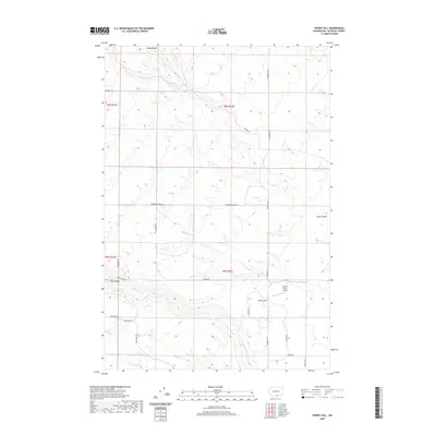
2020 Map of Phinny Hill
USGS Topo · Published 2020About this map
Phinny Hill rises as a central landmark in this portion of Klickitat County, where the high plateau is incised by deep drainage systems like Dead Canyon and Tule Canyon. The landscape is defined by large-scale agricultural and ranching operations, evidenced by the extensive grid of access roads including Peterson Ranch Rd and Alderdale Rd. In the southeastern quadrant, the presence of the Mercer Ranch Airport underscores the importance of private aviation in managing these expansive rural landholdings. Seasonal watercourses such as Alder Cr cut through the terrain, illustrating the natural erosion patterns that have shaped the region's topography. The map detail reflects a modern rural infrastructure of named ranch roads like Gandy Rd and Windmill Rd, which serve the remote homesteads and agricultural tracts of the eastern Washington interior.
Find a feature on this map
23 named features on this map. Tap any name to fly to it.
Don’t see what you’re looking for? This feature index may not catch every label — zoom into the map to look around manually.
Map Details
Editions of this 2020 Phinny Hill Map
This is the sole edition of this map. No revisions or reprints were ever made.
Other maps of this area

1906 · Blalock Island
USGS Topo · 1:125,000

1908 · Blalock Island
USGS Topo · 1:125,000

1910 · Zillah
USGS Topo · 1:125,000

1915 · Prosser
USGS Topo · 1:125,000

1916 · Arlington
USGS Topo · 1:125,000

1917 · Prosser
USGS Topo · 1:125,000

1950 · Yakima
USGS Topo · 1:250,000

1953 · Pendleton
USGS Topo · 1:250,000

1953 · Walla Walla
USGS Topo · 1:250,000

1953 · The Dalles
USGS Topo · 1:250,000