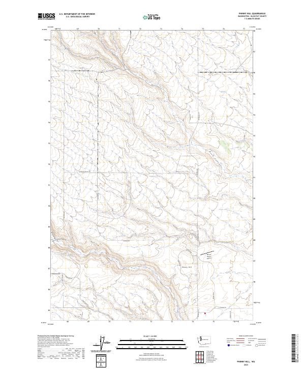
2023 Map of Phinny Hill
USGS Topo · Published 2023About this map
Phinny Hill rises as the central topographic landmark in this Klickitat County landscape, defined by a series of north-south drainage systems and agricultural access routes. The southern portion of the sheet is marked by the course of Alder Creek, which flows past the Mercer Ranch Airport and intersects with local transit corridors like Alder Creek Rd and Alderdale Rd. Significant erosion features, such as Tule Canyon and the winding Dead Canyon, underscore the geological character of the region. The network of rural roads, including Peterson Ranch Rd and Sand Ridge Rd, illustrates the continued importance of land-use divisions within the township and range system, specifically within the t5n r23e and t6n r23e boundaries.
Find a feature on this map
23 named features on this map. Tap any name to fly to it.
Don’t see what you’re looking for? This feature index may not catch every label — zoom into the map to look around manually.
Map Details
Editions of this 2023 Phinny Hill Map
This is the sole edition of this map. No revisions or reprints were ever made.
Other maps of this area

1906 · Blalock Island
USGS Topo · 1:125,000

1908 · Blalock Island
USGS Topo · 1:125,000

1910 · Zillah
USGS Topo · 1:125,000

1915 · Prosser
USGS Topo · 1:125,000

1916 · Arlington
USGS Topo · 1:125,000

1917 · Prosser
USGS Topo · 1:125,000

1950 · Yakima
USGS Topo · 1:250,000

1953 · Pendleton
USGS Topo · 1:250,000

1953 · Walla Walla
USGS Topo · 1:250,000

1953 · The Dalles
USGS Topo · 1:250,000