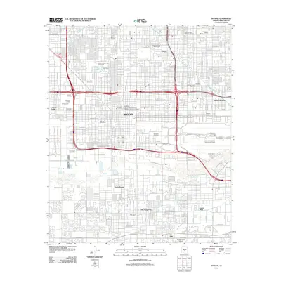
2011 Map of Phoenix
USGS Topo · Published 2011About this map
The Salt River and Grand Canal carve through the urban grid of the Arizona capital in this early 21st-century record. The map reveals a dense concentration of civic history near the city center, notably a cluster of burial grounds including Old City Cemetery, Porter Cemetery, and Rosedale Cemetery south of the Arizona State Fairgrounds. The layout illustrates the massive scale of regional transportation and infrastructure, from the sprawling Phoenix Sky Harbor International Airport to the Arizona Highway Maintenance Durango Yard. Educational and residential expansion is evident through the Arizona State University Downtown Phoenix Campus and established neighborhoods like Rancho Hermoso and South Phoenix. Other distinctive landmarks such as the Bronze Boot and Encanto Lagoon suggest the varied recreational and commercial character of the metropolitan landscape.
Find a feature on this map
96 named features on this map. Tap any name to fly to it.
Don’t see what you’re looking for? This feature index may not catch every label — zoom into the map to look around manually.
Map Details
Editions of this 2011 Phoenix Map
This is the sole edition of this map. No revisions or reprints were ever made.
Other maps of this area

1904 · Camelback
USGS Topo · 1:62,500

1906 · Camelsback
USGS Topo · 1:62,500

1912 · Phoenix
USGS Topo · 1:62,500

1913 · Mesa
USGS Topo · 1:62,500

1914 · Phoenix
USGS Topo · 1:62,500

1915 · Mesa
USGS Topo · 1:62,500

1930 · Cave Creek
USGS Topo · 1:125,000

1939 · Cave Creek
USGS Topo · 1:125,000

1952 · Tempe
USGS Topo · 1:24,000

1952 · Lone Butte
USGS Topo · 1:24,000