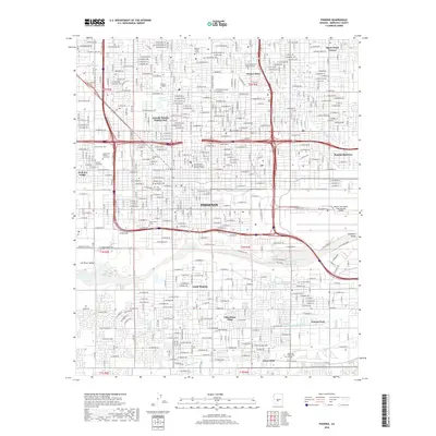
2018 Map of Phoenix
USGS Topo · Published 2018About this map
The Salt River corridor anchors the southern half of this urban survey, where the river's bed cuts through the Salt River Valley just south of downtown Phoenix. This 2018 record shows a landscape defined by an extensive grid of irrigation and transport, including the Grand Canal and the branching San Francisco Canal N Br and San Francisco Canal S Br. This irrigation infrastructure remains a critical component of the metropolitan footprint, even as residential neighborhoods like South Phoenix, Villa Monte Vista, and Citrus Hills fill the spaces between the canals.
Find a feature on this map
48 named features on this map. Tap any name to fly to it.
Don’t see what you’re looking for? This feature index may not catch every label — zoom into the map to look around manually.
Map Details
Editions of this 2018 Phoenix Map
This is the sole edition of this map. No revisions or reprints were ever made.
Other maps of this area

1904 · Camelback
USGS Topo · 1:62,500

1906 · Camelsback
USGS Topo · 1:62,500

1912 · Phoenix
USGS Topo · 1:62,500

1913 · Mesa
USGS Topo · 1:62,500

1914 · Phoenix
USGS Topo · 1:62,500

1915 · Mesa
USGS Topo · 1:62,500

1930 · Cave Creek
USGS Topo · 1:125,000

1939 · Cave Creek
USGS Topo · 1:125,000

1952 · Tempe
USGS Topo · 1:24,000

1952 · Lone Butte
USGS Topo · 1:24,000