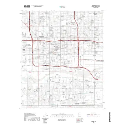
2021 Map of Phoenix
USGS Topo · Published 2021About this map
The Salt River channel and its wide Salt River Valley dominate the southern portion of this urban survey, illustrating the geographical foundations of the state capital. The city's civic heart is densely mapped with institutional landmarks, including the Arizona Supreme Court, the Maricopa County Old Courthouse, and multiple university campuses such as Arizona State University Downtown Phoenix Campus. This area also preserves significant local history through its numerous burial grounds, from the large Greenwood Memory Lawn Mortuary and Cem to the Pioneer and Military Memorial Park Cem. The northern landscape is defined by the Grand Canal and the recreational waters of Encanto Lagoon. Heavy transportation infrastructure is anchored by the sprawling grounds of Phoenix Sky Harbor International Airport and a complex grid of major avenues like W Indian School Rd and W McDowell Rd.
Find a feature on this map
241 named features on this map. Tap any name to fly to it.
Don’t see what you’re looking for? This feature index may not catch every label — zoom into the map to look around manually.
Map Details
Editions of this 2021 Phoenix Map
This is the sole edition of this map. No revisions or reprints were ever made.
Other maps of this area

1904 · Camelback
USGS Topo · 1:62,500

1906 · Camelsback
USGS Topo · 1:62,500

1912 · Phoenix
USGS Topo · 1:62,500

1913 · Mesa
USGS Topo · 1:62,500

1914 · Phoenix
USGS Topo · 1:62,500

1915 · Mesa
USGS Topo · 1:62,500

1930 · Cave Creek
USGS Topo · 1:125,000

1939 · Cave Creek
USGS Topo · 1:125,000

1952 · Tempe
USGS Topo · 1:24,000

1952 · Lone Butte
USGS Topo · 1:24,000