
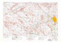
1969 Map of Phoenix
USGS Topo · Published 1970About this map
Phoenix and its surrounding desert basins are captured here during a period of significant suburban expansion, visualized through experimental space photomapping from Apollo 9. The burgeoning developments of Sun City and Glendale contrast with the rugged terrain of the White Tank Mountains and Sierra Estrella. To the west, the landscape is defined by traditional mining and ranching areas, including the historic Vulture Mine and the remote Kofa Game Range. The map highlights the vital role of water management in this arid region, showing the Gila River corridor, Painted Rock Reservoir, and the Agua Fria River feeding into Lake Pleasant. This composite view integrates satellite-era technology with traditional topographic surveying, documenting the intersection of military installations like Luke Air Force Base and the extensive transportation networks of the Southern Pacific and Atchison Topeka & Santa Fe railroads.
Find a feature on this map
89 named features on this map. Tap any name to fly to it.
Don’t see what you’re looking for? This feature index may not catch every label — zoom into the map to look around manually.
Map Details
Editions of this 1969 Phoenix Map
2 editions found
Other maps of this area

1887 · Verde
USGS Topo · 1:250,000

1887 · Prescott
USGS Topo · 1:250,000

1892 · Verde
USGS Topo · 1:250,000

1892 · Prescott
USGS Topo · 1:250,000

1903 · Bradshaw Mountains
USGS Topo · 1:125,000

1903 · Congress
USGS Topo · 1:125,000

1904 · Camelback
USGS Topo · 1:62,500

1904 · Congress
USGS Topo · 1:125,000

1906 · Camelsback
USGS Topo · 1:62,500

1911 · Parker
USGS Topo · 1:125,000