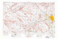
1969 Map of Phoenix
USGS Topo · Published 1971About this map
Glendale and Phoenix appear as established urban centers in this late 1960s revision, while the surrounding desert landscape remains defined by its historical mining and agricultural roots. The eastern portion of the map showcases rapid suburban development with newer communities like Sun City and Youngtown beginning to spread north of the Salt River. To the west, the arid basin-and-range topography is dominated by the Harquahala Mountains and the Vulture Gold Mine, an area still characterized by sparse settlements and the long corridors of the Atchison Topeka & Santa Fe railroad. Military aviation plays a significant role in the local geography, represented by the expansive grounds of Luke Air Force Base and its satellite fields. The map captures a vital hydrological network where the Gila River, Agua Fria River, and Hassayampa River converge in the Buckeye Valley, reflecting the irrigation-dependent economy of central Arizona.
Find a feature on this map
69 named features on this map. Tap any name to fly to it.
Don’t see what you’re looking for? This feature index may not catch every label — zoom into the map to look around manually.
Map Details
Editions of this 1969 Phoenix Map
2 editions found

Other maps of this area

1887 · Verde
USGS Topo · 1:250,000

1887 · Prescott
USGS Topo · 1:250,000

1892 · Verde
USGS Topo · 1:250,000

1892 · Prescott
USGS Topo · 1:250,000

1903 · Bradshaw Mountains
USGS Topo · 1:125,000

1903 · Congress
USGS Topo · 1:125,000

1904 · Camelback
USGS Topo · 1:62,500

1904 · Congress
USGS Topo · 1:125,000

1906 · Camelsback
USGS Topo · 1:62,500

1911 · Parker
USGS Topo · 1:125,000