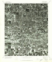
1971 Map of Phoenix
USGS Topo · Published 1972About this map
The sprawling grid of Phoenix dominates this 1971 orthophotomosaic, revealing a dense urban landscape in the midst of rapid desert expansion. The aerial perspective captures the complex texture of the city's growth, from the tightly packed residential blocks and commercial corridors of the central district to the industrial and agricultural zones bordering the Salt River. To the south, South Phoenix appears as a distinct area where the urban pattern begins to soften into larger tracts and less dense development, reflecting the city's southward reach toward the river's edge. This detailed photographic record provides a clear look at the mid-century infrastructure, transportation arteries, and irrigation patterns that transformed the Maricopa County desert into a major metropolitan hub.
Find a feature on this map
3 named features on this map. Tap any name to fly to it.
Don’t see what you’re looking for? This feature index may not catch every label — zoom into the map to look around manually.
Map Details
Editions of this 1971 Phoenix Map
This is the sole edition of this map. No revisions or reprints were ever made.
Other maps of this area

1904 · Camelback
USGS Topo · 1:62,500

1906 · Camelsback
USGS Topo · 1:62,500

1912 · Phoenix
USGS Topo · 1:62,500

1913 · Mesa
USGS Topo · 1:62,500

1914 · Phoenix
USGS Topo · 1:62,500

1915 · Mesa
USGS Topo · 1:62,500

1930 · Cave Creek
USGS Topo · 1:125,000

1939 · Cave Creek
USGS Topo · 1:125,000

1952 · Tempe
USGS Topo · 1:24,000

1952 · Lone Butte
USGS Topo · 1:24,000