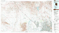
1988 Map of Phoenix North
USGS Topo · Published 1989About this map
The Hassayampa Plain and the Wickenburg Mountains dominate the western horizon of this 1980s-era landscape, where the agricultural past of the Salt River Valley meets modern urban expansion. The northwestern reaches are defined by the mining legacy of the Vulture Mine and the Lucky Cuss Mine, while the growing retirement communities of Sun City and Sun City West emerge as major residential hubs. Transport and infrastructure are central to the region's development, with the Atchison Topeka and Santa Fe Railway and US Highway 60 cutting a diagonal path toward the Phoenix metropolitan area. Water management is visibly critical, illustrated by the Arizona Canal and Beardsley Canal systems which draw from the Agua Fria River. The map also captures significant military and aviation footprints, including Luke Air Force Base and the Luke Air Force Auxiliary Field No 1.
Find a feature on this map
58 named features on this map. Tap any name to fly to it.
Don’t see what you’re looking for? This feature index may not catch every label — zoom into the map to look around manually.
Map Details
Editions of this 1988 Phoenix North Map
2 editions found
Other maps of this area

1887 · Verde
USGS Topo · 1:250,000

1887 · Prescott
USGS Topo · 1:250,000

1892 · Verde
USGS Topo · 1:250,000

1892 · Prescott
USGS Topo · 1:250,000

1903 · Bradshaw Mountains
USGS Topo · 1:125,000

1903 · Congress
USGS Topo · 1:125,000

1904 · Camelback
USGS Topo · 1:62,500

1904 · Congress
USGS Topo · 1:125,000

1906 · Camelsback
USGS Topo · 1:62,500

1912 · Phoenix
USGS Topo · 1:62,500