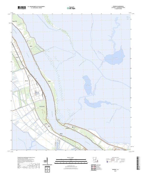
2024 Map of Phoenix
USGS Topo · Published 2024About this map
The Mississippi River creates a winding corridor through Plaquemines Parish, where narrow strips of habitable land are bordered by the intricate canal and bayou networks of the coastal marsh. Settlements like Phoenix and Carlisle cling to the riverbank, following the path of Hwy 15. This landscape is defined by the tension between the river and the encroaching wetlands, evidenced by the numerous drainage and transit canals such as the Forty Arpent Canal and the Back Levee Canal.
Find a feature on this map
49 named features on this map. Tap any name to fly to it.
Don’t see what you’re looking for? This feature index may not catch every label — zoom into the map to look around manually.
Map Details
Editions of this 2024 Phoenix Map
This is the sole edition of this map. No revisions or reprints were ever made.
Other maps of this area

1891 · Pointe a La Hache
USGS Topo · 1:62,500

1891 · New Orleans
USGS Topo · 1:62,500

1892 · Barataria
USGS Topo · 1:62,500

1892 · St. Bernard
USGS Topo · 1:62,500

1892 · Pointe a La Hache
USGS Topo · 1:62,500

1932 · New Orleans SE
USGS Topo · 1:31,680

1935 · Delacroix
USGS Topo · 1:31,680

1935 · Lake Batola
USGS Topo · 1:31,680

1939 · Pointe a La Hache
USGS Topo · 1:62,500
1940 · Belle Chasse
USGS Topo · 1:31,680