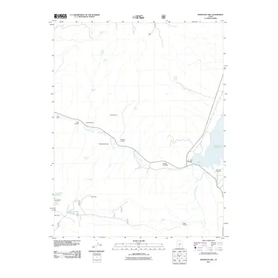
2011 Map of Phonolite Hill
USGS Topo · Published 2011About this map
Otter Creek Reservoir dominates the eastern edge of this high-elevation landscape, secured by the Otter Creek Dam and supported by the Otter Creek Campground. The watershed is defined by the East Fork Sevier River, which winds through varied terrain including Steens Meadow and McCardy Canyon. Numerous named water sources, such as Hodge Ranch Spring and Blood Mirie Spring, highlight the importance of water management in this arid region, connecting the hydrologic network to remote landmarks like Sams Cabin. The map illustrates a landscape shaped by both geological features like Phonolite Hill and man-made infrastructure, including the Road Hollow Reservoir and Corral Flat Reservoir, reflecting the area's dual use for recreation and water storage.
Find a feature on this map
27 named features on this map. Tap any name to fly to it.
Don’t see what you’re looking for? This feature index may not catch every label — zoom into the map to look around manually.
Map Details
Editions of this 2011 Phonolite Hill Map
This is the sole edition of this map. No revisions or reprints were ever made.
Other maps of this area

1885 · Beaver
USGS Topo · 1:250,000

1885 · Fish Lake
USGS Topo · 1:250,000

1896 · Fish Lake
USGS Topo · 1:250,000

1945 · Marysvale
USGS Topo · 1:62,500

1947 · Marysvale
USGS Topo · 1:62,500

1953 · Richfield
USGS Topo · 1:250,000

1956 · Salina
USGS Topo · 1:250,000

1958 · Richfield
USGS Topo · 1:250,000

1960 · Salina
USGS Topo · 1:250,000

1962 · Salina
USGS Topo · 1:250,000