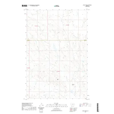
2020 Map of Physic Creek
USGS Topo · Published 2020About this map
Ingersol Butte rises above a series of drainages that define the high plains of Eastern Montana. This 2020 topographic survey spans the border of Prairie and Custer Counties, documenting a landscape primarily shaped by its intermittent water sources and dramatic elevation shifts. Significant water features include the eponymous Physic Cr and its W Fork Physic Cr, along with Sadie Cr and Hunter Cr. Named landmarks like Milwaukee Coulee and Fallon Spring indicate the long-standing importance of reliable water and natural landforms for navigation and survival in this arid environment. The map provides a detailed view of the terrain as it appeared in the early 21st century, showing how geographic features like Hunter Creek Spring and Custer Cr dictate the layout of this sparsely populated region.
Find a feature on this map
14 named features on this map. Tap any name to fly to it.
Don’t see what you’re looking for? This feature index may not catch every label — zoom into the map to look around manually.
Map Details
Editions of this 2020 Physic Creek Map
This is the sole edition of this map. No revisions or reprints were ever made.
Other maps of this area

1953 · Miles City
USGS Topo · 1:250,000

1957 · Miles City
USGS Topo · 1:250,000

1958 · Miles City
USGS Topo · 1:250,000

1965 · Little Sheep Mountain
USGS Topo · 1:24,000

1965 · Morehouse Creek
USGS Topo · 1:24,000

1969 · Kinsey NE
USGS Topo · 1:24,000
1969 · Coal Bank Spring
USGS Topo · 1:24,000
1969 · Kinsey NW
USGS Topo · 1:24,000

1972 · Mc Clure Reservoir
USGS Topo · 1:24,000

1972 · Mc Cloud
USGS Topo · 1:24,000