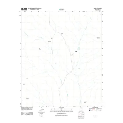
2011 Map of Pia Oik
USGS Topo · Published 2011About this map
Siovi Shuatak and the settlement of Pia Oik anchor this high-desert landscape in the Tohono O'odham Nation during the early 21st century. The map reveals a complex system of drainage basins where the Siovi Shuatak Wash and Pia Oik Wash navigate between several prominent landforms, including the Gu Vo Hills and the northern reaches of the Ajo Range. Transport in this arid region is defined by Route 1 Bia and Indian Rte-1, which provide the primary connectivity through the wide corridors of the Barajita Valley and Pia Oik Valley.
Find a feature on this map
16 named features on this map. Tap any name to fly to it.
Don’t see what you’re looking for? This feature index may not catch every label — zoom into the map to look around manually.
Map Details
Editions of this 2011 Pia Oik Map
This is the sole edition of this map. No revisions or reprints were ever made.
Other maps of this area

1953 · Ajo
USGS Topo · 1:250,000

1954 · Sonoyta
USGS Topo · 1:250,000

1957 · Ajo
USGS Topo · 1:250,000

1958 · Ajo
USGS Topo · 1:250,000

1962 · Ajo
USGS Topo · 1:250,000

1963 · Ajo
USGS Topo · 1:250,000

1963 · Kom Vo
USGS Topo · 1:62,500

1963 · Mt. Ajo
USGS Topo · 1:62,500

1963 · Pisinimo
USGS Topo · 1:62,500

1963 · Lukeville
USGS Topo · 1:250,000
Featured Places
- Siovi Shuatak, Gu Vo District
- Pia Oik, Gu Vo District
- Sweetwater, Gu Vo District
- Gu Vo District, AZ
- Pima County, AZ