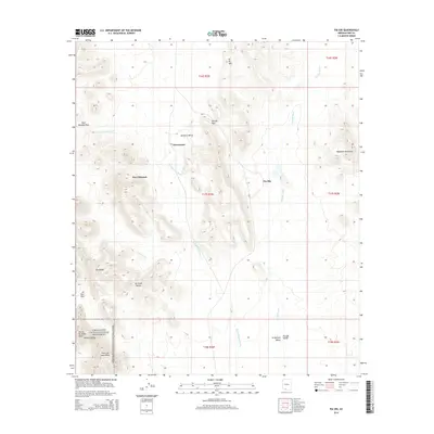
2014 Map of Pia Oik
USGS Topo · Published 2014About this map
Pia Oik and Siovi Shuatak anchor this desert landscape within the Gu Vo District, where traditional settlements follow the natural drainage of Pia Oik Wash and the Siovi Shuatak Wash. The topography is defined by a series of distinct corridors and mountain boundaries, including the Gu Vo Hills to the north and the prominent Ajo Range to the southwest.
Find a feature on this map
25 named features on this map. Tap any name to fly to it.
Don’t see what you’re looking for? This feature index may not catch every label — zoom into the map to look around manually.
Map Details
Editions of this 2014 Pia Oik Map
This is the sole edition of this map. No revisions or reprints were ever made.
Other maps of this area

1953 · Ajo
USGS Topo · 1:250,000

1954 · Sonoyta
USGS Topo · 1:250,000

1957 · Ajo
USGS Topo · 1:250,000

1958 · Ajo
USGS Topo · 1:250,000

1962 · Ajo
USGS Topo · 1:250,000

1963 · Ajo
USGS Topo · 1:250,000

1963 · Kom Vo
USGS Topo · 1:62,500

1963 · Mt. Ajo
USGS Topo · 1:62,500

1963 · Pisinimo
USGS Topo · 1:62,500

1963 · Lukeville
USGS Topo · 1:250,000
Featured Places
- Siovi Shuatak, Gu Vo District
- Pia Oik, Gu Vo District
- Sweetwater, Gu Vo District
- Gu Vo District, AZ
- Pima County, AZ