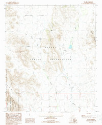
1988 Map of Pia Oik
USGS Topo · Published 1988About this map
The Papago Indian Reservation defines this arid landscape, where desert hydrology and traditional land use are visible through features like Pia Oik and its corresponding Pia Oik Wash. The map records specific historical footprints, including former settlement locations such as Sweetwater (Site) and Siovi Shuatak (Site), providing essential data for genealogists and regional historians.
Find a feature on this map
19 named features on this map. Tap any name to fly to it.
Don’t see what you’re looking for? This feature index may not catch every label — zoom into the map to look around manually.
Map Details
Editions of this 1988 Pia Oik Map
This is the sole edition of this map. No revisions or reprints were ever made.
Other maps of this area

1953 · Ajo
USGS Topo · 1:250,000

1954 · Sonoyta
USGS Topo · 1:250,000

1957 · Ajo
USGS Topo · 1:250,000

1958 · Ajo
USGS Topo · 1:250,000

1962 · Ajo
USGS Topo · 1:250,000

1963 · Ajo
USGS Topo · 1:250,000

1963 · Kom Vo
USGS Topo · 1:62,500

1963 · Mt. Ajo
USGS Topo · 1:62,500

1963 · Pisinimo
USGS Topo · 1:62,500

1963 · Lukeville
USGS Topo · 1:250,000
Featured Places
- Gu Vo District, AZ
- Sweetwater, Gu Vo District
- Siovi Shuatak, Gu Vo District
- Pia Oik, Gu Vo District
- Pima County, AZ