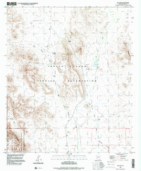
1996 Map of Pia Oik
USGS Topo · Published 2000About this map
Tohono O'odham Indian Reservation lands dominate this mid-1990s topographic study, illustrating a landscape defined by seasonal washes and significant cultural sites. The settlement of Pia Oik sits at the center of the sheet, while former habitation areas are noted at Sweetwater and Siovi Shuatak. The terrain transitions from the open expanses of the Barajita Valley in the north to the jagged elevations of the Gu Vo Hills and the Mesquite Mountains. In the southwest corner, the map captures a portion of the Organ Pipe Cactus National Monument and its associated Organ Pipe Cactus Wilderness. The mapping of small features like the Cem near Siovi Shuatak and the Adams Well Corral provides essential context for researchers tracing land use and community history in this part of Pima County.
Find a feature on this map
19 named features on this map. Tap any name to fly to it.
Don’t see what you’re looking for? This feature index may not catch every label — zoom into the map to look around manually.
Map Details
Editions of this 1996 Pia Oik Map
This is the sole edition of this map. No revisions or reprints were ever made.
Other maps of this area

1953 · Ajo
USGS Topo · 1:250,000

1954 · Sonoyta
USGS Topo · 1:250,000

1957 · Ajo
USGS Topo · 1:250,000

1958 · Ajo
USGS Topo · 1:250,000

1962 · Ajo
USGS Topo · 1:250,000

1963 · Ajo
USGS Topo · 1:250,000

1963 · Kom Vo
USGS Topo · 1:62,500

1963 · Mt. Ajo
USGS Topo · 1:62,500

1963 · Pisinimo
USGS Topo · 1:62,500

1963 · Lukeville
USGS Topo · 1:250,000
Featured Places
- Gu Vo District, AZ
- Sweetwater, Gu Vo District
- Siovi Shuatak, Gu Vo District
- Pia Oik, Gu Vo District
- Pima County, AZ