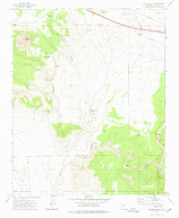
1973 Map of Picacho Butte
USGS Topo · Published 1976About this map
Picacho Butte rises prominently above the complex drainage systems of north-central Arizona, where the high desert meets the northern reaches of the Big Chino Valley. This 1970s landscape is defined by its water management for ranching, evidenced by numerous named stock tanks including McIntyre Tank, New Pete Lockett Tank, and the Rafter M Bar Tank. The topography reveals a network of deep incisions such as McIntyre Canyon and Pete Lockett Canyon, which channel seasonal runoff toward the Big Chino Wash.
Find a feature on this map
28 named features on this map. Tap any name to fly to it.
Don’t see what you’re looking for? This feature index may not catch every label — zoom into the map to look around manually.
Map Details
Editions of this 1973 Picacho Butte Map
This is the sole edition of this map. No revisions or reprints were ever made.
Other maps of this area

1886 · Chino
USGS Topo · 1:250,000

1891 · Chino
USGS Topo · 1:250,000

1947 · Picacho Butte
USGS Topo · 1:62,500

1947 · Turkey Canyon
USGS Topo · 1:62,500

1948 · Williams
USGS Topo · 1:250,000

1948 · Picacho Butte
USGS Topo · 1:63,360

1950 · Turkey Canyon
USGS Topo · 1:62,500

1950 · Picacho Butte
USGS Topo · 1:62,500

1954 · Williams
USGS Topo · 1:250,000

1956 · Williams
USGS Topo · 1:250,000