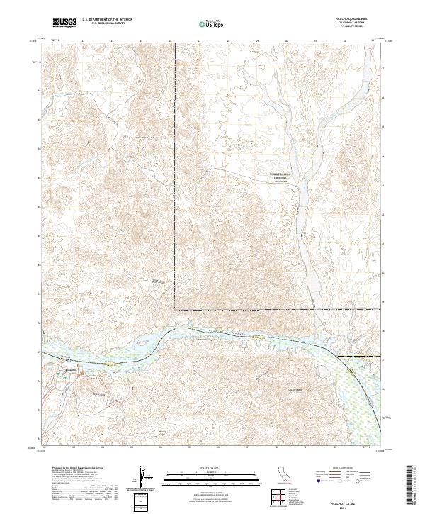
2021 Map of Picacho
USGS Topo · Published 2021About this map
The Colorado River defines the border between California and Arizona in this arid landscape, winding through a complex of riparian habitats and desert uplands. The settlement of Picacho serves as a focal point near the river's edge, surrounded by a network of historic pathways and water bodies including Stewarts Lake, Red Rock Lake, and Clear Lake. The presence of the Red Cloud Mine and access routes like Red Cloud Rd indicate the region's enduring mining history, while unique trail names such as Ice Cream Trl, Stamp Mill Trl, and Rojo Grande suggest more contemporary recreational use of the backcountry. To the north, the Trigo Mountains rise above numerous drainages like Red Cloud Wash and Yuma Wash, illustrating the rugged topography that funnels toward the river valley through landmarks like Cane Break Canyon and Red Rock Gate.
Find a feature on this map
39 named features on this map. Tap any name to fly to it.
Don’t see what you’re looking for? This feature index may not catch every label — zoom into the map to look around manually.
Map Details
Editions of this 2021 Picacho Map
This is the sole edition of this map. No revisions or reprints were ever made.
Other maps of this area

1903 · Yuma
USGS Topo · 1:125,000

1905 · Yuma
USGS Topo · 1:125,000

1929 · Laguna
USGS Topo · 1:62,500

1939 · Red Hill
USGS Topo · 1:62,500

1942 · Yuma
USGS Topo · 1:250,000

1942 · Blythe
USGS Topo · 1:250,000

1943 · Laguna
USGS Topo · 1:62,500

1945 · Picacho Peak
USGS Topo · 1:62,500

1945 · Picacho
USGS Topo · 1:62,500

1951 · Picacho
USGS Topo · 1:62,500