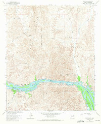
1964 Map of Picacho
USGS Topo · Published 1971About this map
The Trigo Mountains define this landscape, where mining history meets the managed waters of the Colorado River. Along the river's winding path, the Imperial National Wildlife Refuge and Picacho State Recreation Area provide a conservation framework for various water bodies, including Island Lake, Clear Lake, and Ferguson Lake. This area, marking the boundary between Yuma and Imperial counties, is punctuated by evidence of early industrial efforts, most notably the Picacho Mill (Ruin) near the settlement of Picacho.
Find a feature on this map
35 named features on this map. Tap any name to fly to it.
Don’t see what you’re looking for? This feature index may not catch every label — zoom into the map to look around manually.
Map Details
Editions of this 1964 Picacho Map
3 editions found
Other maps of this area

1903 · Yuma
USGS Topo · 1:125,000

1905 · Yuma
USGS Topo · 1:125,000

1929 · Laguna
USGS Topo · 1:62,500

1939 · Red Hill
USGS Topo · 1:62,500

1942 · Yuma
USGS Topo · 1:250,000

1942 · Blythe
USGS Topo · 1:250,000

1943 · Laguna
USGS Topo · 1:62,500

1945 · Picacho Peak
USGS Topo · 1:62,500

1945 · Picacho
USGS Topo · 1:62,500

1951 · Picacho
USGS Topo · 1:62,500