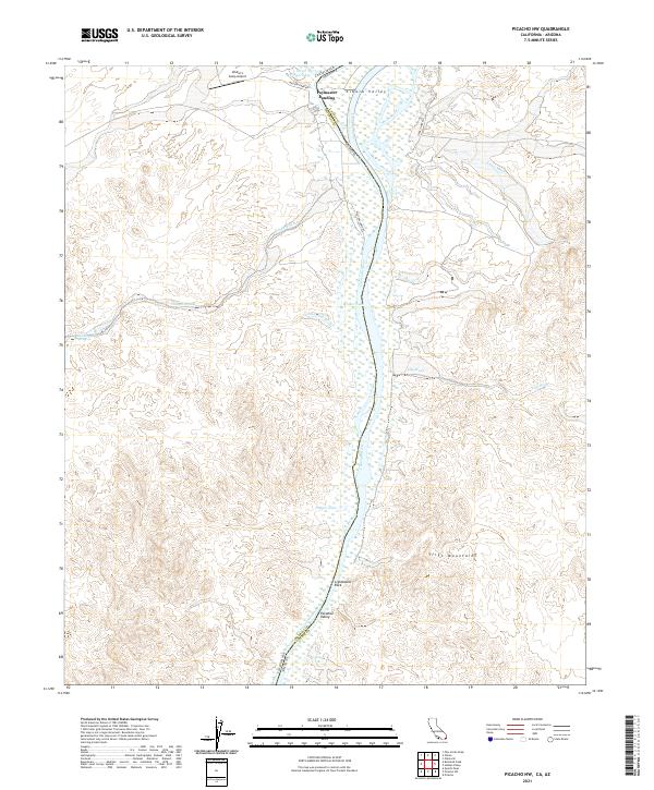
2021 Map of Picacho NW
USGS Topo · Published 2021About this map
The Colorado River defines the border between California and Arizona in this arid riverine landscape, where the fertile Cibola Valley sits in contrast to the high desert terrain. The river is flanked by several backwater features, including Three Finger Lake, Walker Lake, and Draper Lake, illustrating the shifting course and ecological complexity of the lower Colorado. Human activity is centered around the river corridor at Paymaster Landing and Walter's Camp Airport, which provide access to this remote stretch of the valley.
Find a feature on this map
28 named features on this map. Tap any name to fly to it.
Don’t see what you’re looking for? This feature index may not catch every label — zoom into the map to look around manually.
Map Details
Editions of this 2021 Picacho NW Map
This is the sole edition of this map. No revisions or reprints were ever made.
Other maps of this area

1942 · Blythe
USGS Topo · 1:250,000

1945 · Cibola
USGS Topo · 1:62,500

1945 · Picacho
USGS Topo · 1:62,500

1951 · Picacho
USGS Topo · 1:62,500

1951 · Cibola
USGS Topo · 1:62,500

1953 · Palo Verde Mountains
USGS Topo · 1:62,500

1953 · Quartz Peak
USGS Topo · 1:62,500

1954 · Salton Sea
USGS Topo · 1:250,000
1954 · Picacho NW
USGS Topo · 1:24,000
1954 · Picacho SW
USGS Topo · 1:24,000