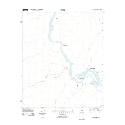
2012 Map of Picacho SW
USGS Topo · Published 2012About this map
The Colorado River defines the heart of this Lower Colorado landscape, winding through a complex network of backwaters and desert washes near the Arizona-California border. In the early 21st century, the river's edge is marked by a series of small riverside settlements and ranch sites including Nommel Place, Hoge Ranch, and Four-S Ranch. The presence of numerous boat-in camps, such as the Carrizo Wash Boat-in Camp and Taylor Lake Boat-in Camp, highlights the importance of the river for modern recreation and access.
Find a feature on this map
32 named features on this map. Tap any name to fly to it.
Don’t see what you’re looking for? This feature index may not catch every label — zoom into the map to look around manually.
Map Details
Editions of this 2012 Picacho SW Map
This is the sole edition of this map. No revisions or reprints were ever made.
Other maps of this area

1903 · Yuma
USGS Topo · 1:125,000

1905 · Yuma
USGS Topo · 1:125,000

1942 · Yuma
USGS Topo · 1:250,000

1942 · Blythe
USGS Topo · 1:250,000

1945 · Picacho Peak
USGS Topo · 1:62,500

1945 · Picacho
USGS Topo · 1:62,500

1951 · Picacho
USGS Topo · 1:62,500

1951 · Picacho Peak
USGS Topo · 1:62,500

1953 · Quartz Peak
USGS Topo · 1:62,500

1953 · Ogilby
USGS Topo · 1:62,500