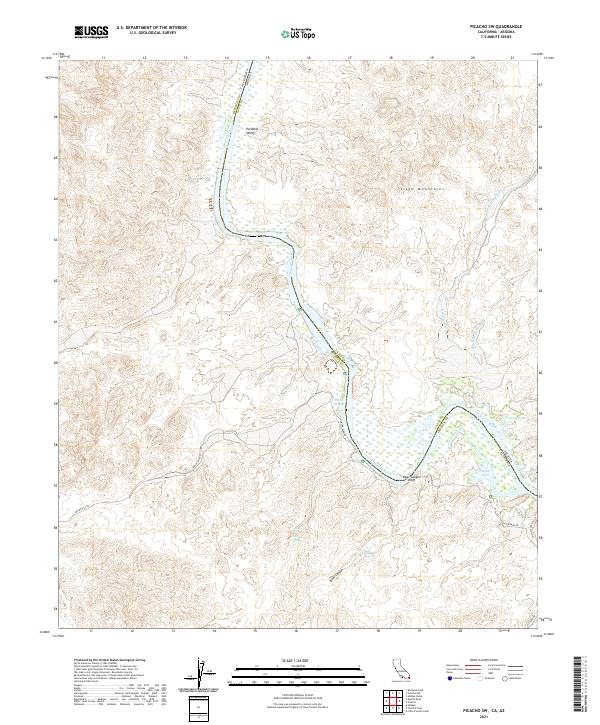
2021 Map of Picacho SW
USGS Topo · Published 2021About this map
The Colorado River defines the border between Imperial County, California, and La Paz County, Arizona, winding through a landscape shaped by intermittent water and high desert relief. This 2021 survey shows a complex network of wetlands and backwaters along the river's eastern bend, including Adobe Lake, Nortons Lake, and Taylor Lake. The settlement of Paradise Valley sits on the California side, positioned near where the river transitions from the high slopes of the Trigo Mountains. To the south, the topography becomes more dramatic at Bear Canyon Bluff and the drainage of Bear Canyon, which contains the named Bear Canyon Falls. Local transit is marked by primitive routes such as Indian Pass Rd and Stewart Lake Trl, reflecting the area's use for recreation and land management. The presence of features like Ruin Slough and Carrizo Spring suggests the critical importance of reliable water sources in this arid environment.
Find a feature on this map
28 named features on this map. Tap any name to fly to it.
Don’t see what you’re looking for? This feature index may not catch every label — zoom into the map to look around manually.
Map Details
Editions of this 2021 Picacho SW Map
This is the sole edition of this map. No revisions or reprints were ever made.
Other maps of this area

1903 · Yuma
USGS Topo · 1:125,000

1905 · Yuma
USGS Topo · 1:125,000

1942 · Yuma
USGS Topo · 1:250,000

1942 · Blythe
USGS Topo · 1:250,000

1945 · Picacho Peak
USGS Topo · 1:62,500

1945 · Picacho
USGS Topo · 1:62,500

1951 · Picacho
USGS Topo · 1:62,500

1951 · Picacho Peak
USGS Topo · 1:62,500

1953 · Quartz Peak
USGS Topo · 1:62,500

1953 · Ogilby
USGS Topo · 1:62,500