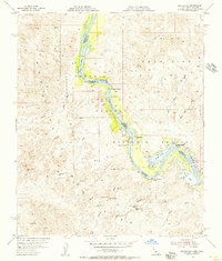
1954 Map of Picacho SW
USGS Topo · Published 1956About this map
The Colorado River winds through the heart of this mid-century survey, defining the border between Imperial County, California, and Yuma County, Arizona. This section of the river valley is largely occupied by the Imperial National Wildlife Refuge, where the main channel is flanked by a complex network of backwaters including Adobe Lake, Taylor Lake, and Nortons Lake. The map identifies several historical occupation sites along the riverbanks, notably Nortons Landing, Nommel Place, and Hoge Ranch.
Find a feature on this map
31 named features on this map. Tap any name to fly to it.
Don’t see what you’re looking for? This feature index may not catch every label — zoom into the map to look around manually.
Map Details
Editions of this 1954 Picacho SW Map
This is the sole edition of this map. No revisions or reprints were ever made.
Other maps of this area

1903 · Yuma
USGS Topo · 1:125,000

1905 · Yuma
USGS Topo · 1:125,000

1942 · Yuma
USGS Topo · 1:250,000

1942 · Blythe
USGS Topo · 1:250,000

1945 · Picacho Peak
USGS Topo · 1:62,500

1945 · Picacho
USGS Topo · 1:62,500

1951 · Picacho
USGS Topo · 1:62,500

1951 · Picacho Peak
USGS Topo · 1:62,500

1953 · Quartz Peak
USGS Topo · 1:62,500

1953 · Ogilby
USGS Topo · 1:62,500