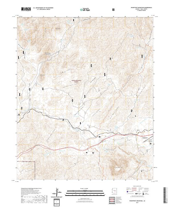
2021 Map of Picketpost Mountain
USGS Topo · Published 2021About this map
The town of Superior serves as a gateway to the high-relief terrain of the Tonto National Forest, where canyon networks and volcanic summits define the Arizona landscape. This 2021 record captures a mix of modern infrastructure and legacy landmarks, including the Superior Municipal Airport and the Historic Pinal Cem. The passage of Us HWY 60 crosses the Queen Creek Bridge as it navigates the transition between the valley floor and the heights of Picketpost Mtn.
Find a feature on this map
55 named features on this map. Tap any name to fly to it.
Don’t see what you’re looking for? This feature index may not catch every label — zoom into the map to look around manually.
Map Details
Editions of this 2021 Picketpost Mountain Map
This is the sole edition of this map. No revisions or reprints were ever made.
Other maps of this area

1900 · Florence
USGS Topo · 1:125,000

1902 · Florence
USGS Topo · 1:125,000

1948 · Superior
USGS Topo · 1:62,500

1948 · Superior
USGS Topo · 1:24,000

1948 · Iron Mountain
USGS Topo · 1:24,000
1948 · Haunted Canyon
USGS Topo · 1:24,000

1948 · Picketpost Mtn
USGS Topo · 1:24,000

1949 · Superior
USGS Topo · 1:24,000

1949 · Iron Mountain
USGS Topo · 1:24,000
1949 · Haunted Canyon
USGS Topo · 1:24,000