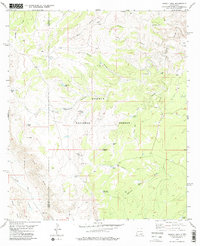
1979 Map of Pickett Hill
USGS Topo · Published 1979About this map
The boundary between Otero County and Eddy County cuts through this arid landscape within the Lincoln National Forest during the late 1970s. The terrain is defined by a complex network of drainages and dramatic elevation shifts, most notably at the escarpment of The Rim in the southwest. Water management is central to the area's utility, evidenced by numerous man-made catchments like Anderson Tank, Keller Tank, and Pickett Tanks, alongside wells such as the Shattuck Well and Middleton Well. This infrastructure supported grazing and ranching operations in a region carved by deep incisions like Last Chance Canyon and Upper Dog Canyon. The map reveals a land utilized for more than just range, with several Gravel Pits and a prominent Radio Tower near the summit of Pickett Hill, reflecting the technological and industrial needs of the era.
Find a feature on this map
33 named features on this map. Tap any name to fly to it.
Don’t see what you’re looking for? This feature index may not catch every label — zoom into the map to look around manually.
Map Details
Editions of this 1979 Pickett Hill Map
This is the sole edition of this map. No revisions or reprints were ever made.
Other maps of this area

1935 · El Paso Gap
USGS Topo · 1:62,500

1936 · El Paso Gap
USGS Topo · 1:48,000

1940 · El Paso Gap
USGS Topo · 1:62,500

1940 · Bandanna Point
USGS Topo · 1:62,500

1940 · Carlsbad Caverns West
USGS Topo · 1:62,500

1943 · Carlsbad Caverns West
USGS Topo · 1:62,500

1943 · Bandanna Point
USGS Topo · 1:62,500

1943 · Texas Hill
USGS Topo · 1:62,500

1945 · Texas Hill
USGS Topo · 1:62,500

1954 · Carlsbad
USGS Topo · 1:250,000