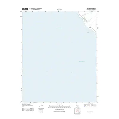
2012 Map of Pico Creek
USGS Topo · Published 2012About this map
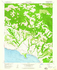
The Pacific Ocean dominates this coastal survey, where the Santa Lucia Range foothills meet the Central California shore. The map centers on the drainage of Pico Cr and its tributary, S Fork Pico Cr, as they flow toward the sea near the prominent landmark of Pico Rock. Development is concentrated in a small residential corridor between San Simeon Rd and the coastline, featuring local streets such as Pico Ave and Avonne Ave. The settlement of The Oaks marks the southern extent of this coastal enclave. The terrain is defined by the winding course of Arroyo Del Padre Juan, which cuts through the bluffs just north of the community. This 2012 edition illustrates the sparse, preservation-oriented settlement pattern characteristic of this portion of San Luis Obispo County.
Find a feature on this map
10 named features on this map. Tap any name to fly to it.
Don’t see what you’re looking for? This feature index may not catch every label — zoom into the map to look around manually.
Map Details
Editions of this 2012 Pico Creek Map
This is the sole edition of this map. No revisions or reprints were ever made.
Other maps of this area

1919 · Piedras Blancas
USGS Topo · 1:62,500

1919 · San Simeon
USGS Topo · 1:62,500

1927 · Piedras Blancas
USGS Topo · 1:62,500

1937 · San Simeon
USGS Topo · 1:62,500

1947 · San Luis Obispo
USGS Topo · 1:250,000

1948 · San Luis Obispo
USGS Topo · 1:250,000
1956 · San Luis Obispo
USGS Topo · 1:250,000
1957 · San Luis Obispo
USGS Topo · 1:250,000
1958 · San Luis Obispo
USGS Topo · 1:250,000
1958 · San Simeon
USGS Topo · 1:24,000