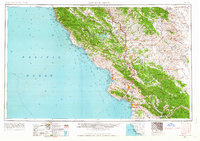
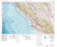
1956 Map of San Luis Obispo
USGS Topo · Published 1963About this map
The Santa Lucia Range dominates the western coastline of Central California in this mid-century topographic survey, where Highway 101 serves as the primary artery connecting inland valleys. At this time, the Southern Pacific Railroad remains a vital transport link, shadowing the Salinas River through San Miguel and Paso Robles. The landscape reveals a diverse mix of agricultural basins and large-scale military holdings, most notably the Hunter Liggett Military Reservation and Camp Roberts Military Reservation flanking the northern boundary.
Find a feature on this map
113 named features on this map. Tap any name to fly to it.
Don’t see what you’re looking for? This feature index may not catch every label — zoom into the map to look around manually.
Map Details
Editions of this 1956 San Luis Obispo Map
5 editions found
Other maps of this area

1897 · Port Harford
USGS Topo · 1:62,500

1897 · San Luis Obispo
USGS Topo · 1:62,500

1897 · Cayucos
USGS Topo · 1:62,500

1897 · Arroyo Grande
USGS Topo · 1:62,500

1900 · San Luis
USGS Topo · 1:125,000

1902 · Santa Ynez
USGS Topo · 1:125,000

1905 · Guadalupe
USGS Topo · 1:125,000

1905 · Santa Ynez
USGS Topo · 1:125,000

1905 · Lompoc
USGS Topo · 1:125,000

1912 · Coalinga
USGS Topo · 1:125,000