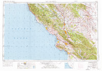
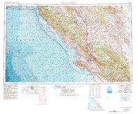
1956 Map of San Luis Obispo
USGS Topo · Published 1976About this map
San Luis Obispo and the central coast of California are depicted here during a period of significant mid-century development. The Southern Pacific railroad and U S 101 serve as the primary north-south corridors, connecting a string of coastal and inland communities from San Simeon down through Pismo Beach. The landscape is defined by its dramatic transition from the rugged Santa Lucia Range and Los Padres National Forest in the west to the stark agricultural and tectonic features of the Carrizo Plain and the San Andreas Rift Valley in the east.
Find a feature on this map
108 named features on this map. Tap any name to fly to it.
Don’t see what you’re looking for? This feature index may not catch every label — zoom into the map to look around manually.
Map Details
Editions of this 1956 San Luis Obispo Map
5 editions found
Other maps of this area

1897 · Port Harford
USGS Topo · 1:62,500

1897 · San Luis Obispo
USGS Topo · 1:62,500

1897 · Cayucos
USGS Topo · 1:62,500

1897 · Arroyo Grande
USGS Topo · 1:62,500

1900 · San Luis
USGS Topo · 1:125,000

1902 · Santa Ynez
USGS Topo · 1:125,000

1905 · Guadalupe
USGS Topo · 1:125,000

1905 · Santa Ynez
USGS Topo · 1:125,000

1905 · Lompoc
USGS Topo · 1:125,000

1912 · Coalinga
USGS Topo · 1:125,000