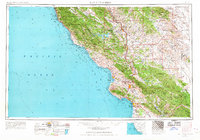
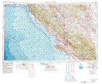
1956 Map of San Luis Obispo
USGS Topo · Published 1967About this map
The Santa Lucia Range dominates the Central Coast landscape, stretching from the northern coastal peaks down toward the valley floors. This mid-century survey captures a period of coastal development and military presence, highlighting the sprawling Hunter Liggett Military Reservation and Camp Roberts Military Reservation near the Salinas River. Along the shore, traditional fishing and ranching outposts like Cambria and Cayucos appear alongside the expanding seaside communities of Pismo Beach and Morro Bay, the latter marked by the iconic landmark of Morro Rock.
Find a feature on this map
86 named features on this map. Tap any name to fly to it.
Don’t see what you’re looking for? This feature index may not catch every label — zoom into the map to look around manually.
Map Details
Editions of this 1956 San Luis Obispo Map
5 editions found
Other maps of this area

1897 · Port Harford
USGS Topo · 1:62,500

1897 · San Luis Obispo
USGS Topo · 1:62,500

1897 · Cayucos
USGS Topo · 1:62,500

1897 · Arroyo Grande
USGS Topo · 1:62,500

1900 · San Luis
USGS Topo · 1:125,000

1902 · Santa Ynez
USGS Topo · 1:125,000

1905 · Guadalupe
USGS Topo · 1:125,000

1905 · Santa Ynez
USGS Topo · 1:125,000

1905 · Lompoc
USGS Topo · 1:125,000

1912 · Coalinga
USGS Topo · 1:125,000