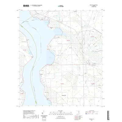
2021 Map of Picolata
USGS Topo · Published 2021About this map
The Saint Johns River dominates this stretch of Saint Johns County, serving as the defining border and historical corridor for settlements like Picolata and Palmo. The landscape is a complex network of wetlands and tidal inlets, including the Big Island Swamp and several family-named points such as Ferreira Point and Watson Island. Inland, the terrain is characterized by broad flats like Dancey Flat and the drainage of Sixmile Creek and Tocoi Cr.
Find a feature on this map
89 named features on this map. Tap any name to fly to it.
Don’t see what you’re looking for? This feature index may not catch every label — zoom into the map to look around manually.
Map Details
Editions of this 2021 Picolata Map
This is the sole edition of this map. No revisions or reprints were ever made.
Other maps of this area

1917 · Orange Park
USGS Topo · 1:62,500

1918 · Orange Park
USGS Topo · 1:62,500

1918 · Palm Valley
USGS Topo · 1:62,500

1937 · Bakersville
USGS Topo · 1:24,000

1937 · Elkton
USGS Topo · 1:24,000

1943 · St. Augustine
USGS Topo · 1:62,500

1947 · Bostwick
USGS Topo · 1:50,000

1948 · Jacksonville
USGS Topo · 1:250,000

1949 · Bostwick
USGS Topo · 1:24,000

1949 · Green Cove Springs
USGS Topo · 1:24,000