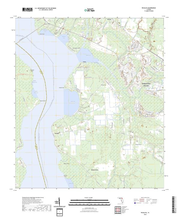
2024 Map of Picolata
USGS Topo · Published 2024About this map
The Saint Johns River defines the western edge of this landscape, its wide expanse punctuated by distinctive features like Jack Wright Island and Smith Point. Along the riverbanks, small settlements such as Picolata and Palmo represent long-standing points of habitation, while inland development is anchored by World Golf Village and the planned communities around Meldrim Park. The area's complex hydrography is evident in the winding courses of Sixmile Creek and Wards Creek, which feed into the river alongside significant wetlands like Big Island Swamp.
Find a feature on this map
97 named features on this map. Tap any name to fly to it.
Don’t see what you’re looking for? This feature index may not catch every label — zoom into the map to look around manually.
Map Details
Editions of this 2024 Picolata Map
This is the sole edition of this map. No revisions or reprints were ever made.
Other maps of this area

1917 · Orange Park
USGS Topo · 1:62,500

1918 · Orange Park
USGS Topo · 1:62,500

1918 · Palm Valley
USGS Topo · 1:62,500

1937 · Bakersville
USGS Topo · 1:24,000

1937 · Elkton
USGS Topo · 1:24,000

1943 · St. Augustine
USGS Topo · 1:62,500

1947 · Bostwick
USGS Topo · 1:50,000

1948 · Jacksonville
USGS Topo · 1:250,000

1949 · Bostwick
USGS Topo · 1:24,000

1949 · Green Cove Springs
USGS Topo · 1:24,000