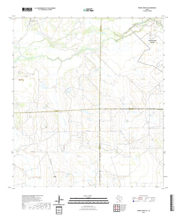
2022 Map of Piedra Creek SE
USGS Topo · Published 2022About this map
The Nueces River winds through this South Texas landscape where the boundaries of La Salle, Webb, McMullen, and Duval counties converge. This ranching and water-focused geography is defined by a network of drainage systems, including Piedra Cr, Charamusca Cr, and Juanita Cr. The land use is characterized by specialized infrastructure like the Gould Strip landing area and the Arnold Lake Dam, which regulates the seasonal flow of local tributaries. For those researching local families, the Adams Cem stands as a primary genealogical landmark near Pintas Adami N Rd. The area also features unique desert water sources such as Charamusca Lake Number 7 and Bowles Lake, reflecting the importance of water management in this sparsely populated territory.
Find a feature on this map
21 named features on this map. Tap any name to fly to it.
Don’t see what you’re looking for? This feature index may not catch every label — zoom into the map to look around manually.
Map Details
Editions of this 2022 Piedra Creek SE Map
This is the sole edition of this map. No revisions or reprints were ever made.
Other maps of this area

1937 · Loma Alta
USGS Topo · 1:62,500

1953 · Crystal City
USGS Topo · 1:250,000

1955 · Crystal City
USGS Topo · 1:250,000

1956 · Freer
USGS Topo · 1:62,500

1956 · Piedra Creek
USGS Topo · 1:62,500

1956 · Las Mujeres
USGS Topo · 1:62,500

1956 · Laredo
USGS Topo · 1:250,000

1961 · Crystal City
USGS Topo · 1:250,000

1968 · Crystal City
USGS Topo · 1:250,000
1969 · Mirasol Creek
USGS Topo · 1:24,000