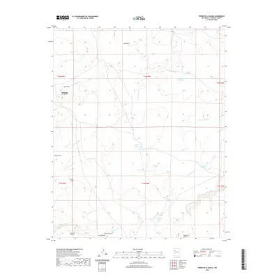
2020 Map of Piedra De La Aguila
USGS Topo · Published 2020About this map
Piedra de la Aguila marks the high ground in this high-desert landscape of McKinley County, where the terrain is defined by a complex network of seasonal watercourses and lagunas. The drainage patterns are dominated by the Arroyo Leon system, including its north and south forks, which weave through the arid floor alongside named landmarks like Mesita Gato and Voght Draw. Several catchment basins or seasonal ponds, such as Laguna Trujillo, Laguna Huero, and Tinaja Lake, suggest the importance of water management in this sparsely settled region.
Find a feature on this map
29 named features on this map. Tap any name to fly to it.
Don’t see what you’re looking for? This feature index may not catch every label — zoom into the map to look around manually.
Map Details
Editions of this 2020 Piedra De La Aguila Map
This is the sole edition of this map. No revisions or reprints were ever made.
Other maps of this area

1883 · Mt. Taylor
USGS Topo · 1:250,000

1886 · Mt. Taylor
USGS Topo · 1:250,000

1892 · Mt. Taylor
USGS Topo · 1:250,000

1899 · Mt. Taylor
USGS Topo · 1:250,000

1957 · Ambrosia Lake
USGS Topo · 1:24,000

1958 · Albuquerque
USGS Topo · 1:250,000

1961 · El Dado
USGS Topo · 1:24,000

1961 · Piedra De La Aguila
USGS Topo · 1:24,000

1961 · Hospah
USGS Topo · 1:24,000
1961 · Mesita Americana
USGS Topo · 1:24,000