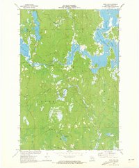
1971 Map of Pier Lake
USGS Topo · Published 1973About this map
The Willow Reservoir and Tomahawk River define this complex Northwoods drainage system in western Oneida County. Surveyed at the start of the 1970s, the landscape is a mosaic of glacial water bodies and winding streams, including Pier Lake, Willow Lake, and the smaller Lake Junnie to the west. While much of the land is categorized under townships like Lynne and Little Rice, the human footprint is primarily limited to forest management roads and small lakeside outposts. St Francis of Assisi Ch serves as a lone spiritual landmark near the northwestern shore of the reservoir. Notable natural features like Lamer Springs and the Willow Rapids indicate the varied flow of the watershed before it joins the Little Rice River and Little Somo River in the south.
Find a feature on this map
30 named features on this map. Tap any name to fly to it.
Don’t see what you’re looking for? This feature index may not catch every label — zoom into the map to look around manually.
Map Details
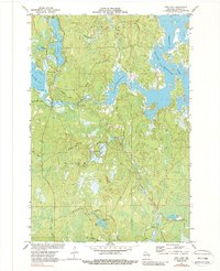
Editions of this 1971 Pier Lake Map
2 editions found
Other maps of this area

1938 · Lac Du Flambeau
USGS Topo · 1:48,000

1939 · Lac Du Flambeau
USGS Topo · 1:48,000

1939 · Mc Cord
USGS Topo · 1:48,000

1941 · Pike Lake
USGS Topo · 1:48,000

1941 · Brantwood
USGS Topo · 1:48,000

1942 · Pike Lake
USGS Topo · 1:48,000

1943 · Brantwood
USGS Topo · 1:48,000

1946 · Lac Du Flambeau
USGS Topo · 1:48,000

1947 · Mc Cord
USGS Topo · 1:48,000

1950 · Pike Lake
USGS Topo · 1:48,000